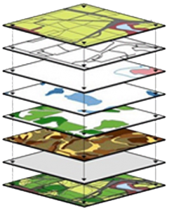
Geographic Information Systems (GIS)
 GIS is a general concept; There are GIS applications developed for various usages and thematic issues. These GIS applications, Urban Information System, Forest Information System, Highways Information System, Land Information System, Land Registry and Cadastre Information System, Logistics Information System, Homeland Security Information System, Vehicle Monitoring Information System, Traffic Information System, Campus Information System, Earthquake Information System, Map Information System, etc. they are named.
AREA OF USAGE
GIS technology scientific research, resource management, asset management, archeology, environmental impact assessment, urban planning, cartography, criminology, geographical history, marketing, logistics, mine mapping, determination of cultivated agricultural areas and calculation of total crop, military applications, air, sea and land traffic monitoring vehicle tracking systems can be used for meteorology, search and rescue, market / public survey and many other similar purposes.


